City adds BikeNewark’s new information kiosks

photo of kiosk
One of four information kiosks to be installed in Newark parks along Newark Bikeways routes

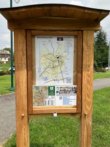
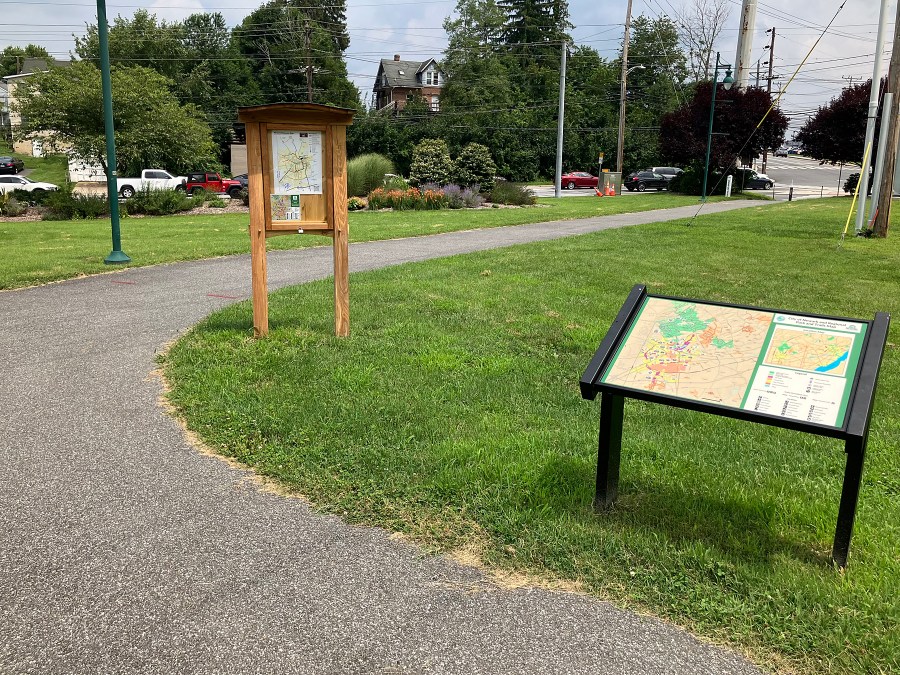
Recently, the City installed three of four planned information kiosks, paid for through grants secured by BikeNewark, in city parks as a guide supplement to BikeNewark’s low-stress network wayfinding signage. Each kiosk contains our Bikeways map and a city Area Recreation Amenities resource map.

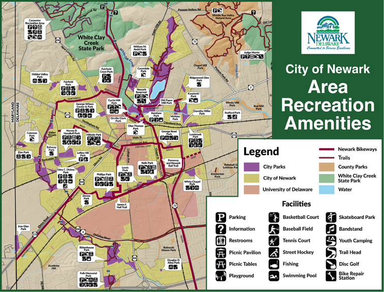
Partnering with the City of Newark Department of Parks & Recreation, BikeNewark produced the resource map (shown below), which highlights area parks, noting specific park amenities with an overlay of the Newark Bikeways low-stress network, as well as many off-road trails.

Area Recreation Amenities graphic

Kiosks have been installed in Phillips Park along the James F. Hall Trail (where the Southwest Bikeway meets the Central Loop), at the junction of the Hall and Pomeroy Trails (Central Loop), and in Olan Thomas Park along the Pomeroy Trail (North Bikeway). The fourth kiosks will be installed in Hillside Park (West Bikeway).

photo of kiosk position in Olan Thomas Park
One of the kiosk locations is Olan Thomas Park, along the Pomeroy Trail, part of the North Bikeway.

> Area Recreation Amenities map (PDF)
> Newark Bikeways map (PDF)

Delaware Avenue taking on new shape

What began as a dream at a BikeNewark (then Newark Bicycle Committee) meeting in 2014 is finally taking shape as part of DelDOT’s Delaware Avenue pave-and-rehab project. Coming on the heels of the massive Main Street renovation, this project includes a major amenity for bicyclists—a two-way separated bikeway (a.k.a. cycletrack)—on the north side of the road.

These photos, taken on July 27, 2022, show the progress along various sections of this major eastbound route through the heart of Newark.

photo of Del. Ave. WB
westbound between S. College Ave. and Orchard Rd., showing concrete protected-lane separator
photo of Del. Ave. EB
eastbound between Academy St. and Haines St., showing concrete protected-lane separator

This new cycletrack feature, which will be a first of its type in Delaware, will enable legal westbound bicycle traffic from the Pomeroy Trail to Orchard Road. Bike traffic on the western end of this project will be shuttled to/from Orchard Road and Amstel Ave. as a continuation to/from South Main Street.

East of the Pomeroy Trail all the way to Library Avenue, there will be one-way raised lanes on either side of Delaware Avenue.

photo of island at Pomeroy Trail WB
new island at Pomeroy Trail crossing westbound, marking change from two-way to one-way (WB)
photo of Del. Ave. curve WB
westbound at the curve toward Newark Transit Hub, showing raised bike lanes (in black)
photo of Del. Ave. curve EB
eastbound at the curve toward Newark High School, showing raised bike lanes (in black)

The other notable new feature will be the raised-profile intersection at South College Avenue. This feature will help pedestrians walk across at the sidewalk level, eliminating potential curb missteps and will also act as a traffic-calming aid.

photo of Del. Ave. raised intersection (south section) at S. College Ave.
raised intersection (south half) at South College Avenue, level with sidewalks

> see related Newark Post article