by Sophia Marianiello
Introduction
Last fall, in the process of collecting data for the 2025 update to the Newark Bicycle Plan, I ended up visiting all 36 of Newark’s city parks. (I was checking how many bike racks each of them had. The answer, for most of them: none. And you thought finding parking on Main Street was hard!)
Since then, I’ve wondered how many Newarkers can say that they’ve been to all of our parks, or even heard of them all. And this spring, as BikeNewark was preparing for Bike to Work Day 2025, I thought, “What if I visited all our parks again, by bike, and blogged about it, for the sake of everyone who enjoys parks in Newark, biking in Newark, or biking to parks in Newark?”
I ran this by exactly one other BikeNewark member and got a reply of “Go for it!”, which was enough encouragement for me. So, here are the (entirely self-imposed) rules of the (so-called) Newark park tour:
- I‘ll visit all the parks within the Newark city limits, and only parks within the Newark city limits.
- To make this task a little easier, I‘ll split up the parks by city council district, visiting all the parks in District 1 on one trip, all the parks in District 2 on another trip, and so on. (The council district map is included just below this list.)
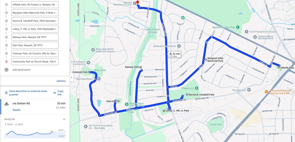
- I’ll show the route I take to get from park to park and share a few pictures of each park and its amenities.
- I’ll travel from park to park by biking or walking only. No cars allowed. Public transit is okay to get to the first park in a route or get home from the last park in a route.
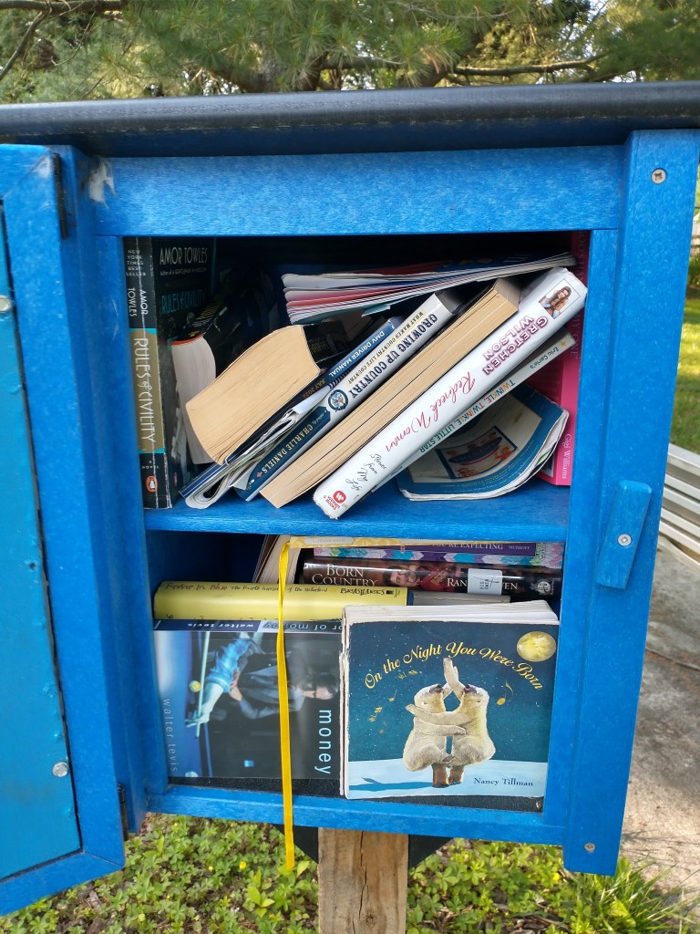
- I‘ll check out the contents of every “Little Free Library” associated with a park.
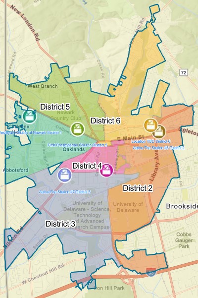
Let’s start at the very beginning—a very good place to start: District 1, in West Newark, a roughly triangular district bounded by Route 273, the CSX Railroad, and the Maryland border.
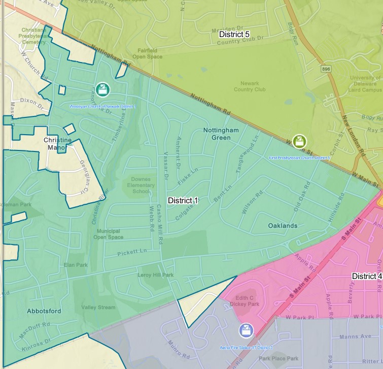
District 1 has seven city parks: Hillside Park, Margaret Allen Memorial Park, Norma B. Handloff Park, Leroy C. Hill Park, Rahway Park, Elan Park, and Coleman Park.
Hillside Park
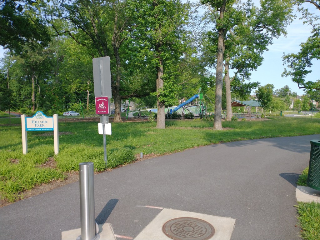
- Location: 151 Forest Lane; off Hillside Road
- Bike parking spaces: 24
- Webpage: https://newarkde.gov/1260/20141/Hillside-Park
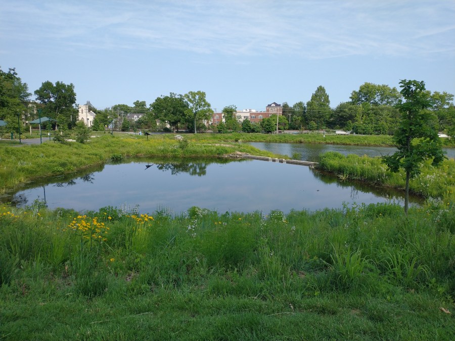
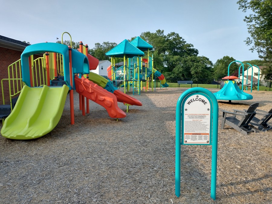
One of Newark’s newest parks, Hillside Park was first conceived as a stormwater-management facility, replacing the University of Delaware’s Caesar Rodney dorms after their closure in 2015 and demolition in 2019. Beyond a stormwater-retention pond, the park’s playground, pavilions, trees and natural spaces, bike racks, paved trail loop, and fishing pier make it a hub of west Newark. On any nice day it’s bustling with kids, parents, students, townies, bikers, walkers, fishers, and geese. (A group of them on the trail almost made me late for work one morning this spring. The geese, I mean.)
The paved trail through Hillside Park is also a keystone of Newark’s West Bikeway, connecting neighborhoods like Oaklands and Nottingham Green to downtown Newark via the railroad underpass that leads to Amstel Avenue.
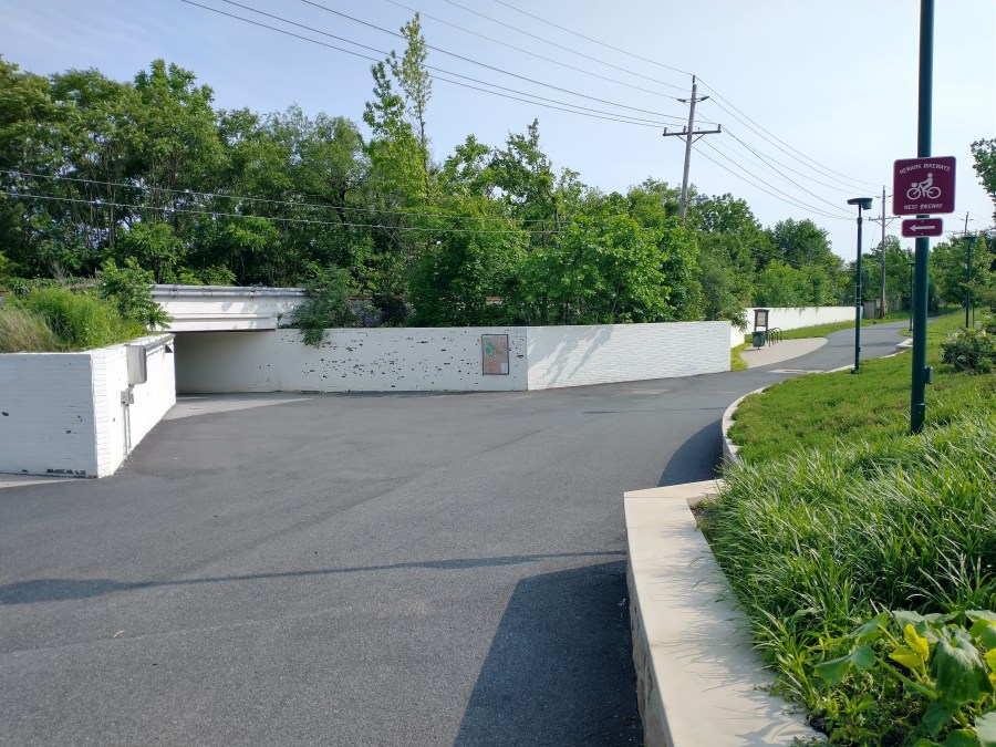
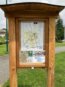
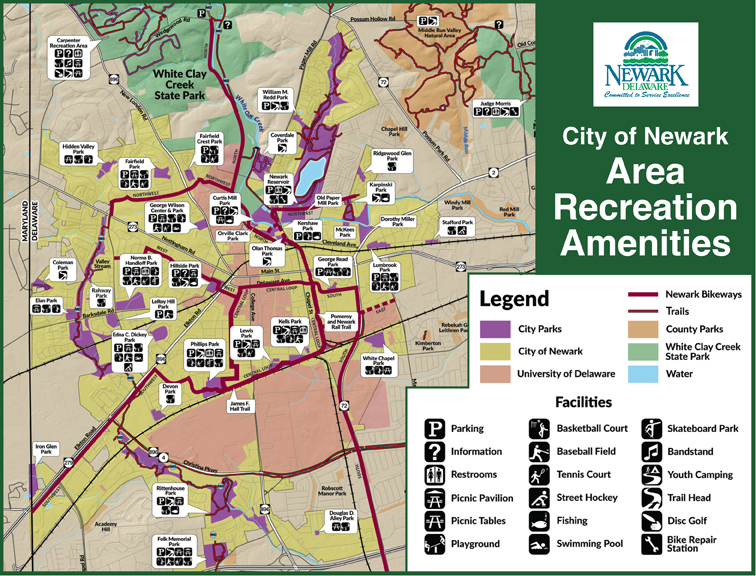
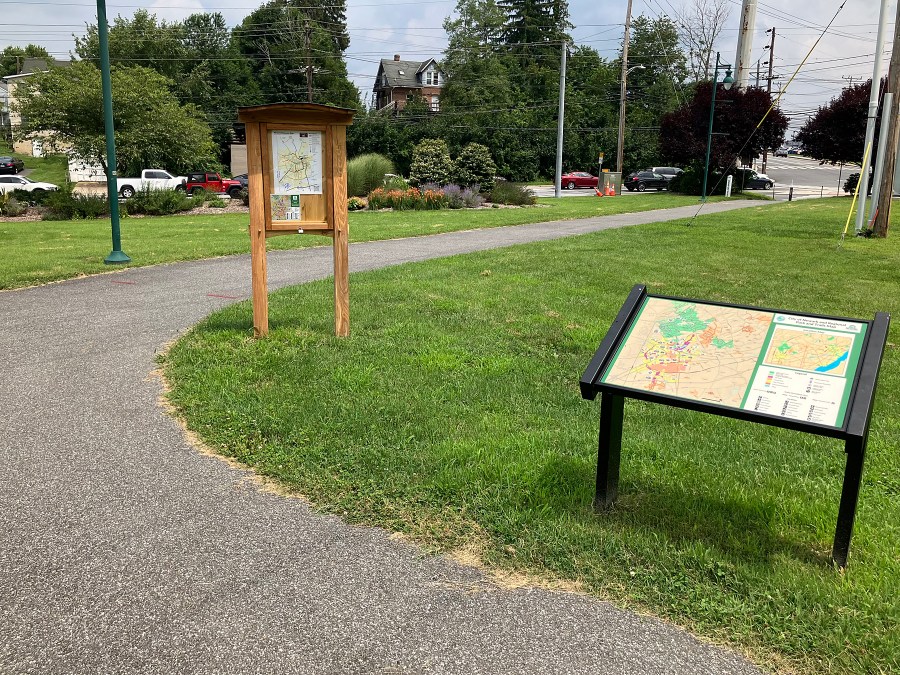
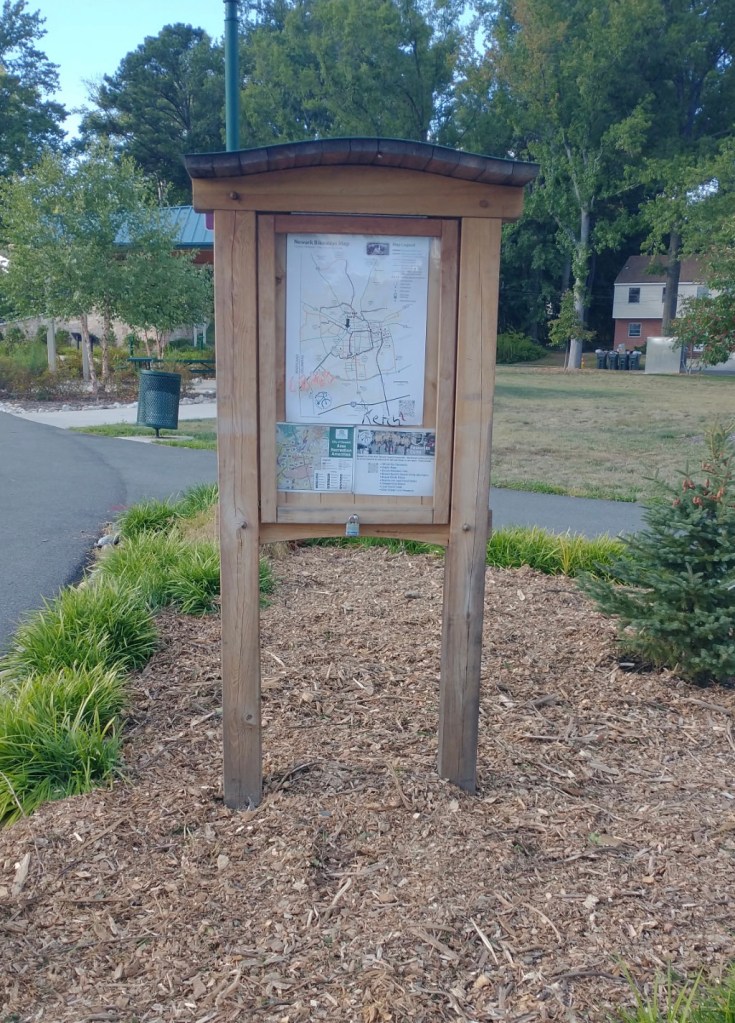
To mark its Bikeway status, Hillside Park has one of BikeNewark’s four information kiosks, containing a map of the Newark Bikeways, a map of recreation amenities in and around Newark, and a QR link to bicycle resources.
Margaret Allen Memorial Park
The trip from Hillside Park to Margaret Allen Memorial Park is an easy one. Take Dallam Road (another component of the West Bikeway) and turn left at Briar Lane (or Bent Lane, if you prefer—either will get you there).
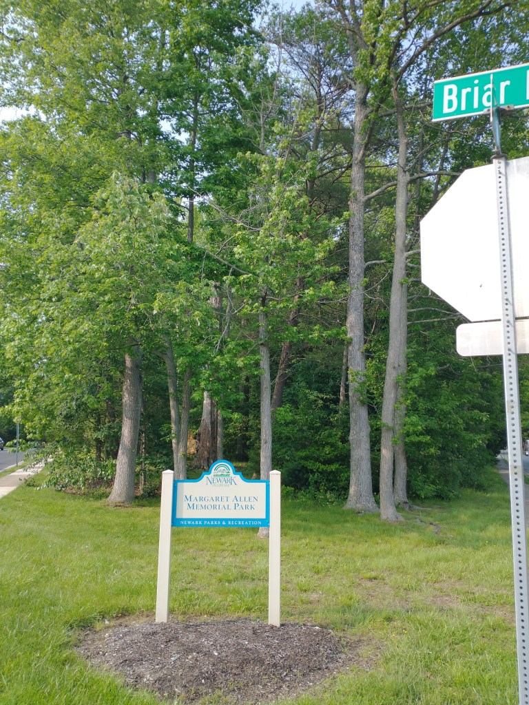
- Location: 0 Briar Lane; on the corner of Bent and Briar Lane, in Nottingham Green
- Bike parking spaces: 0
- Webpage: https://newarkde.gov/1262/20143/Margaret-Allen-Memorial-Park
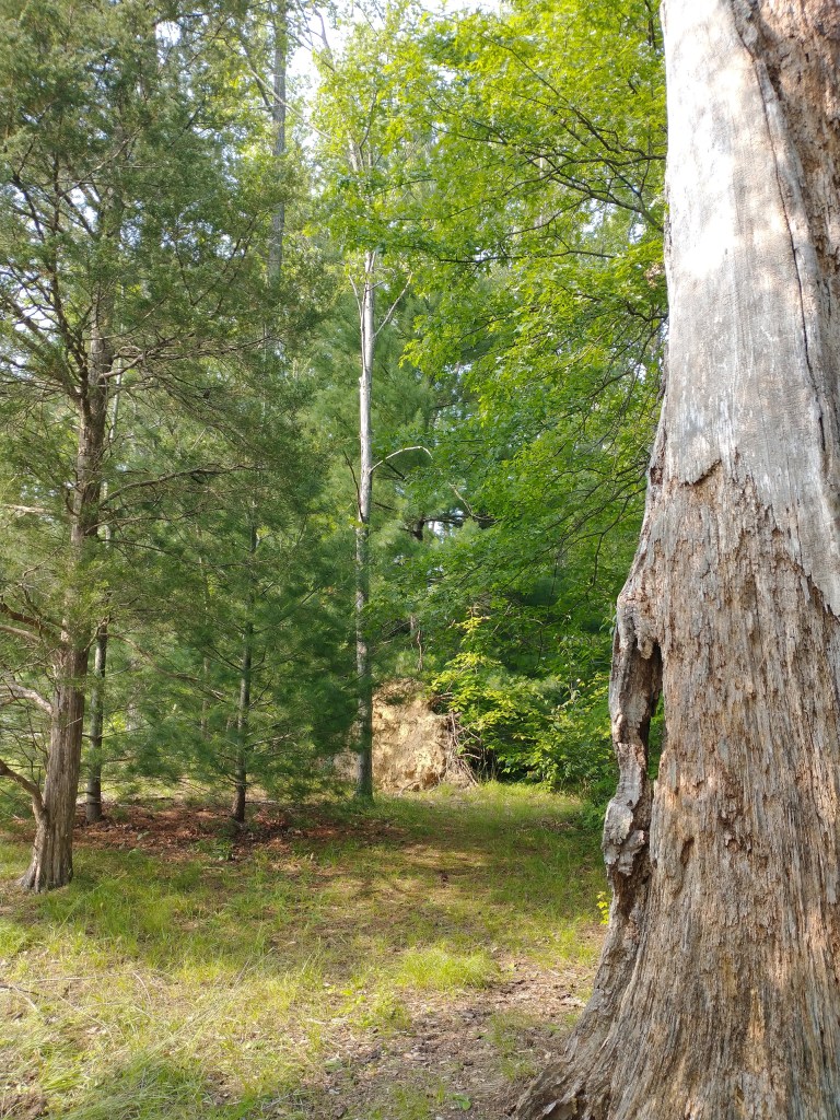
Many of Newark’s parks aren’t your typical playground-and-picnic table recreation space, but natural areas where trees and wildlife can flourish without any more disruption than the occasional dirt trail. Margaret Allen Memorial Park is one such park, and as far as I can tell, it’s also Newark’s smallest park, less than half an acre in area. It’s a patch of forest, taking up the tip of one of the narrow triangular wedges formed by the intersection of Bent Lane and Briar Lane.
The park’s namesake, Margaret Allen, was a Newark resident who donated the land to the City of Newark to be preserved as parkland rather than being developed. The park was named after her in 2023, 24 years after her donation of the land and 16 years after her death.
Norma B. Handloff Park
The trip from Margaret Allen Memorial Park to Norma B. Handloff Park is short, but does require a few tricky left turns. Keep going southwest on Bent Lane, then turn left onto Casho Mill Road, then left onto Barksdale Road. Continue along Barksdale and turn left into either of two parking lots.
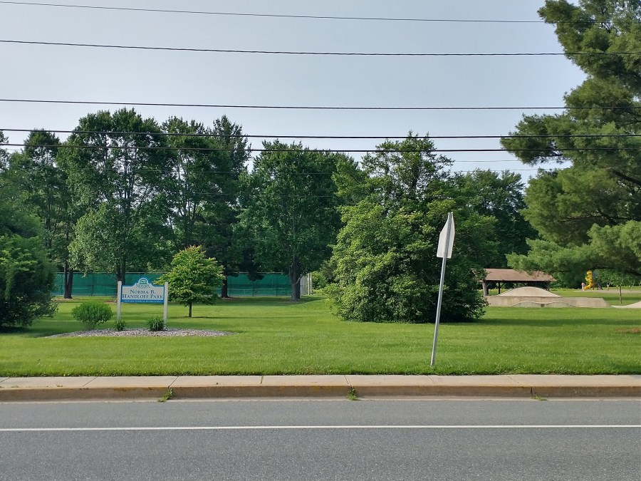
- Location: 1000 Barksdale Road; northeast corner of the Barksdale Road and Casho Mill Road intersection
- Bike parking spaces: 13
- Webpage: https://newarkde.gov/460/Norma-B-Handloff-Park
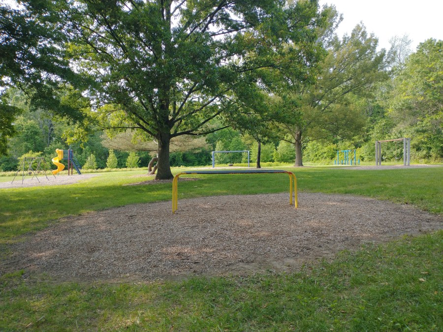
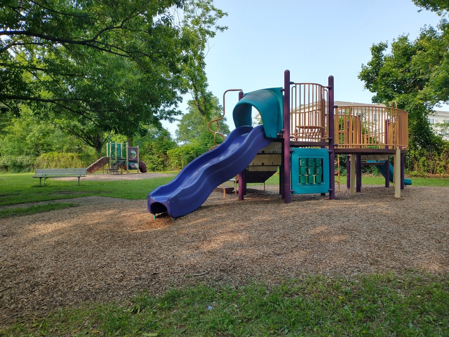
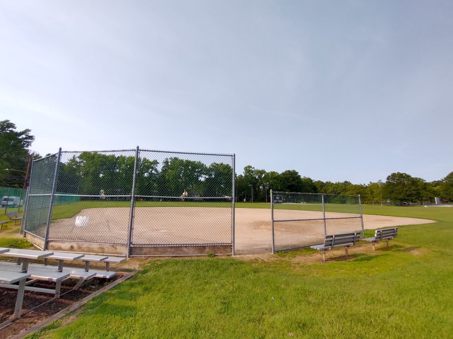
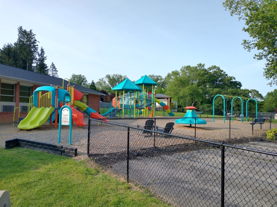
Norma B. Handloff Park was one of the parks I visited most growing up in Newark, and let me tell you, this place has everything—tennis courts; baseball fields; basketball courts with a handball wall; at least eight playsets, swing sets, slides, and other play features, the names of which I don’t even know; the tire swing that was a yearly highlight of the Summer Playground summer camp program; and pavilion with multiple picnic tables! It boasts one of only two skate spots in the city of Newark!
And still, there are huge swathes of open space and many, many trees. (Sadly, the weeping willow tree that gave shelter to Summer Playground campers for years seems to have gone the way of the program itself.) The City’s website also assures me that there’s a new rain garden at the park, though I wasn’t able to see it for myself.
The park’s namesake, Norma B. Handloff, was Newark’s first female mayor, who served from 1967 to 1973 and worked to improve the city’s parks. Fittingly, the park is the site of many city events and classes, including the Parks on Draft concert series and the annual Turkey Trot race.
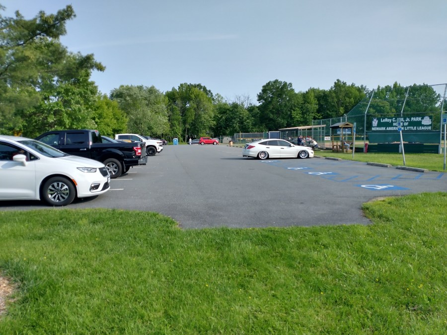
Leroy C. Hill Park
The trip from Norma B. Handloff Park to Leroy C. Hill Park is even shorter. Head back down Barksdale Road, turn left onto Casho Mill Road, and the parking lot is on your right. You might spend longer waiting at the light than you will riding.
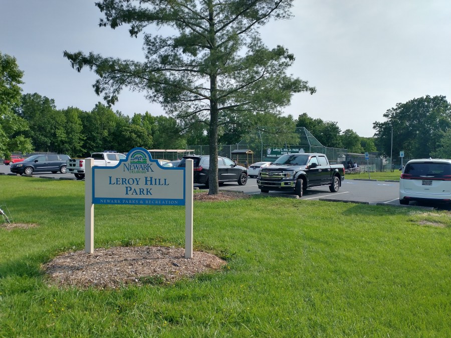
- Location: 1001 Casho Mill Road; southwest corner of the Barksdale and Casho Mill Road intersection
- Bike parking spaces: 0
- Webpage: https://newarkde.gov/455/Leroy-C-Hills-Park
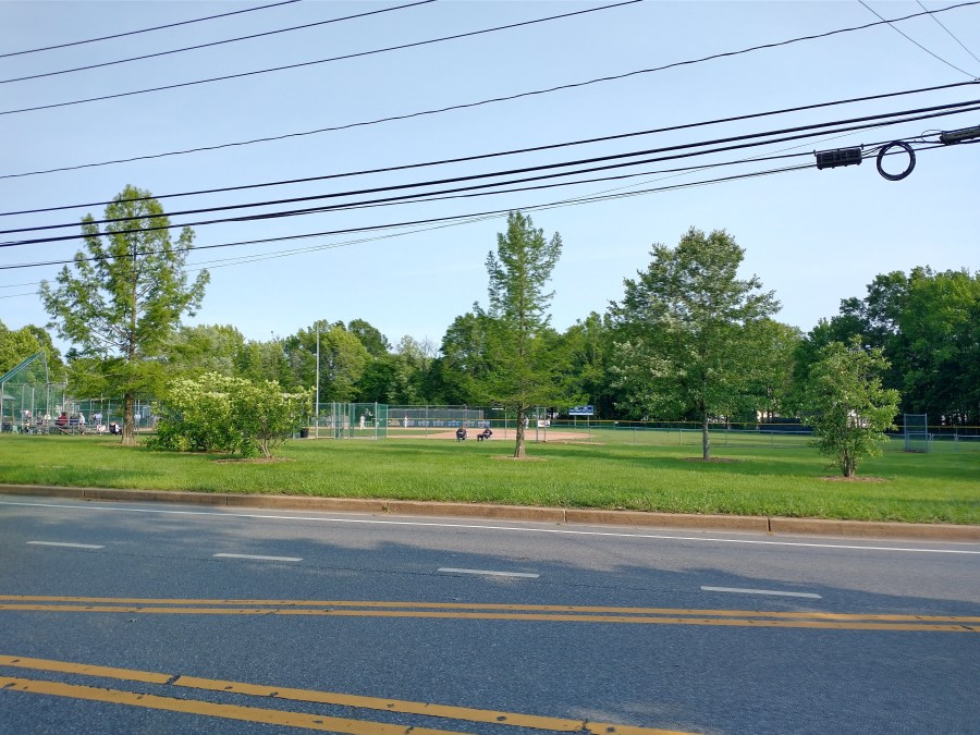
The baseball field at Leroy C. Hill Park is one of the home fields of the Newark American Little League, and also hosts some of Newark Charter High School’s baseball games. What else is at the park, you may ask? Well, there’s a parking lot.
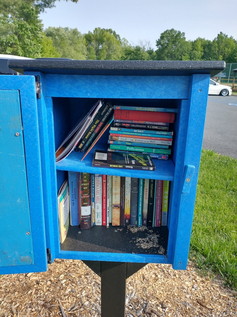
If you’re at Leroy C. Hill Park and you’re not playing or watching baseball, you could: search for a place to lock up your bike; contemplate the fact that the nearest baseball field, directly across the intersection at Norma B. Handloff Park, is less than a tenth of a mile away; or check out the Little Free Library, the first so far on the Newark Park Tour! Unfortunately, when I checked out this Little Free Library, it was full of ants.
Little Free Library Running Total: 1 (District 1) / 1 (All Districts)
The park’s namesake, Leroy C. Hill Jr., was a Newark resident who was thoroughly involved in baseball at the local and national levels. To quote his obituary in the Newark Post:
Hill managed baseball teams for Newark High School and town teams prior to WWII and played in the Susquehanna League afterwards. He also managed Wilmington Truck Body in the Delaware Semi Pro League and the Newark Buccos in the Vic Willis League. He was a professional baseball scout for the Phillies and the Pirates and was a founding member of the Mid Atlantic Major League Baseball Scouts Association. Hill was most proud of his being able to help Vic Willis make it into the Baseball Hall of Fame in Cooperstown, N.Y.
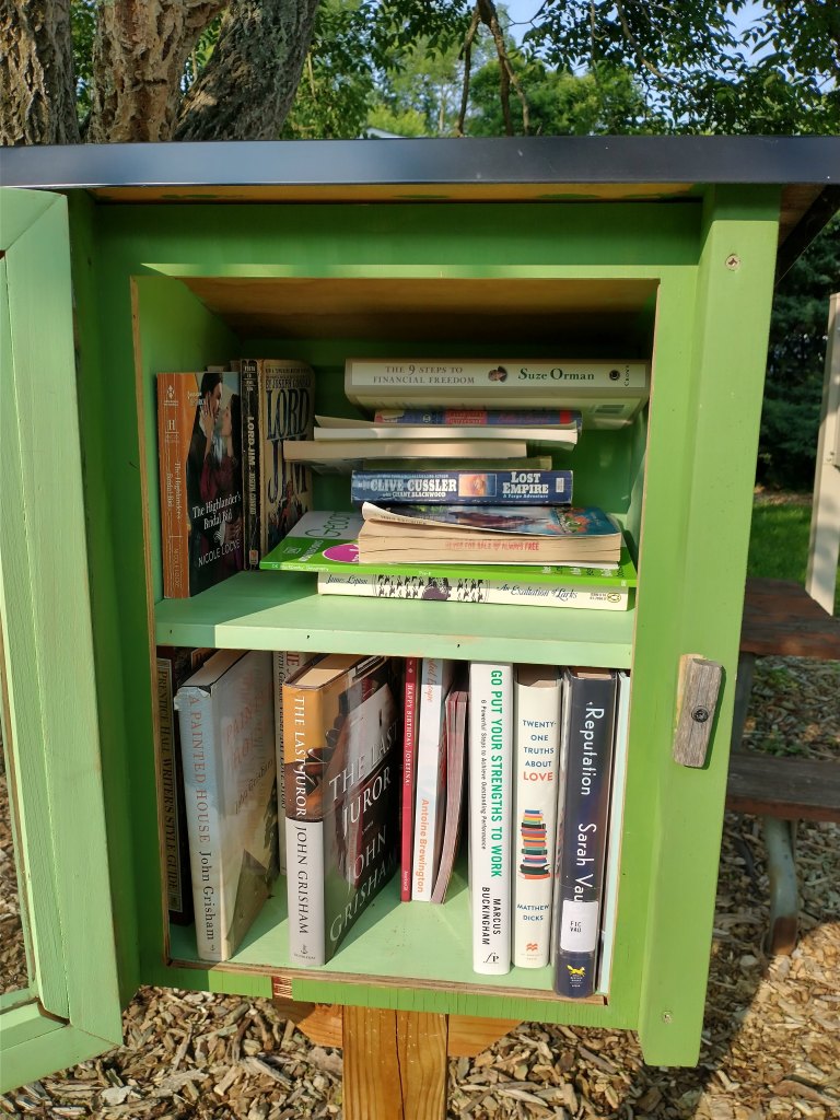
Rahway Park
The trip from Leroy C. Hill Park to Rahway Park requires you to turn left onto Casho Mill Road, for the third and final time this trip, then left onto Barksdale Road, then right onto Rahway Drive. Keep riding until you reach the right-angle bend in Rahway; the park will be on your left.
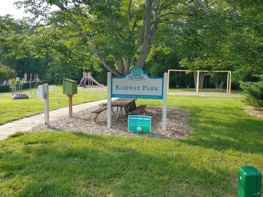
- Location: 922 Rahway Drive; off Barksdale Road, in Cherry Hill
- Bike parking spaces: 0
- Webpage: https://newarkde.gov/465/Rahway-Park
Rahway Park probably qualifies as a pocket park; it’s a small neighborhood park, less than an acre, on a single residential lot between two houses. One swing set and one play feature. (The latter was removed a few weeks after I took this picture, according to the City, and should be replaced soon.) One picnic table, one very climbable-looking tree (sadly, I did not have the time to test this myself), one park bench, and one exhortation to take your trash with you… and one Little Free Library!
Little Free Library Running Total: 2 (District 1) / 2 (All Districts)
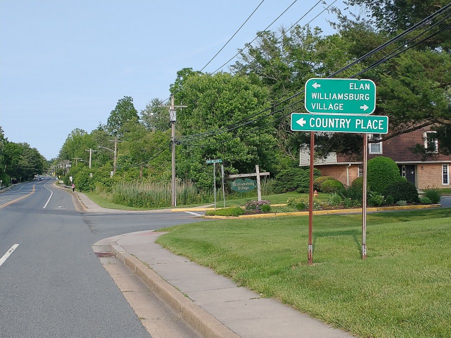
Elan Park
The trip from Rahway Park to Elan Park takes you back down Rahway Drive the way you came, right onto Barksdale Road, and right into Blue Hen Ridge. Slog your way up the hill, and you’ll be rewarded by the park on your right.
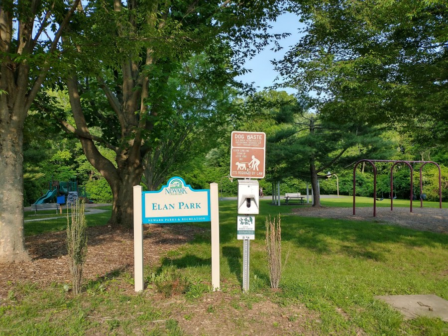
- Location: 2 Blue Hen Ridge; off Barksdale Road, in Country Place
- Bike parking spaces: 0
- Webpage: https://newarkde.gov/426/Elan-Park
Elan Park is a neighborhood park, not unlike Rahway Park, but a little bigger and a little fuller (A backpack park, if you will, rather than a pocket park), with one swing set and one play feature, the latter being more elaborate. There are one picnic table under a pavilion, several trees, a Wildlife Habitat certification, two park benches (at least), and a basketball court. There is only one Little Free Library, though, but I suppose more than one at a park this size would be too extravagant.
Little Free Library Running Total: 3 (District 1) / 3 (All Districts)
The source of Elan Park’s name is hard to track down. The nearby neighborhood of Country Place, which has a sign at the intersection of Blue Hen Ridge and Barksdale Road, actually only includes the townhouses on Chickory Way. The Newark zoning map claims that houses on Blue Hen Ridge and its offshoots of North Fawn Drive, South Fawn Drive, and Squirrel Lane belong to the Hunting Hills subdivision, but also assigns some of them to the community of Elan of Huntington Hills.
Coleman Park
The trip from Elan Park to Coleman Park starts by riding back down Blue Hen Ridge and right onto Barksdale Road yet again. Then turn right onto the aptly named Country Hills Drive and ride all the way to the end. Make sure you brought a bike with gears, or a battery.
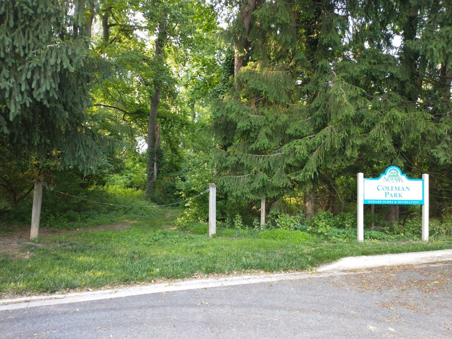
- Location: 42 Country Hills Drive; off Barksdale Road, in Country Hills
- Bike parking spaces: 0
- Webpage: https://newarkde.gov/420/Coleman-Park
Coleman Park is another “natural area and dirt trails” park, though much larger than Margaret Allen Memorial Park. The trail runs from Country Hills Drive through the woods to Valley Road, just a few feet from the Maryland border, and not far from the Briarcreek North neighborhood. At the time of my visit, and the time of writing this, Coleman Park was closed indefinitely for safety reasons. From the Newark Post:
The inspection found that the tree canopy near the entrance to the park consists of many black locust trees that are structurally compromised by fungal decay and pose a significant risk of falling.
The walking paths are eroded and surrounded by dense thickets of greenbrier, multiflora rose and poison ivy.
“These thorny species have overgrown the area and become entangled with large woody debris from fallen trees and limbs,” City Manager Tom Coleman wrote in a memo to city council. “Significant land clearing and tree removal must be completed before we can reopen the park.”
The city does not have funding for such work in the 2025 budget, according to Coleman, who did not provide any indication as to when the park might reopen.
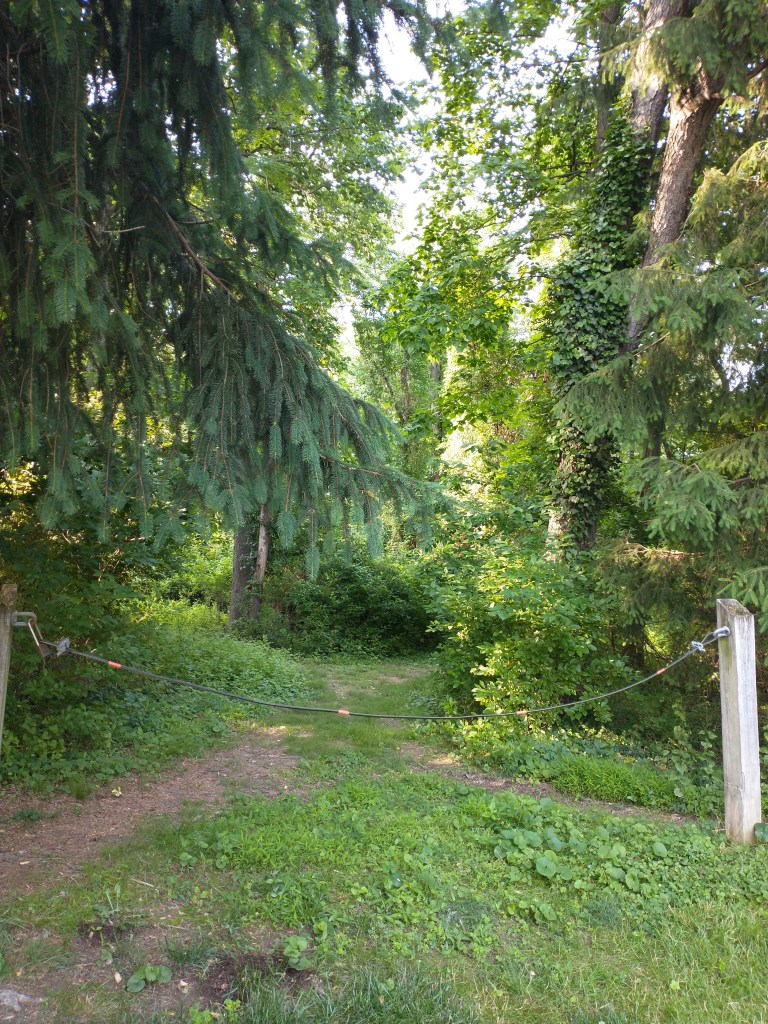
The Newark Post article also contains two further pieces of information about the park: 1) it was purchased and annexed by the city in 1993 and named for the family that used to own it (no relation to the City Manager), and 2) possible future improvements to the park include paving the trail and adding a turf/meadow area. I’ll leave it to residents of the adjacent neighborhoods to decide whether or not these changes would improve the park.
If the trail through Coleman Park were open, the trip to the final park on the list would use it. Instead, you’ll need to ride back down Country Hills Drive, turn left on Barksdale Road and ride half a mile, turn left again on Casho Mill Road and ride three-quarters of a mile, turn left again on West Church Road, and ride up the hill until you spot the park on your right.
BONUS: Community Park at Church Road
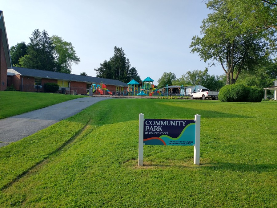
- Location: 708 West Church Road
- Bike parking spaces: 0
The Community Park at Church Road isn’t a City of Newark park, hence the “bonus” status. It’s the property of Newark Wesleyan Church, seen here, but open to the public from dawn to dusk every day. The park, which was opened to the public in the fall of 2024, includes multiple play features, a swing set, a pavilion with two picnic tables, and several park benches and chairs.
District 1 residents may also know Newark Wesleyan Church as their polling place for city elections, such as the elections for mayor and District 1 councilmember held earlier this year. You all voted in that, right?
That completes the tour of District 1’s parks! Next time I’ll be exploring the parks in District 2.